Central America Map Quiz: The Hardest Caribbean Islands and Why Everyone Swaps Honduras for Nicaragua
A central america map quizsounds straightforward — there are only 7 countries on the mainland isthmus, right? But add the 13 Caribbean island nations we include here, and suddenly you're staring at 20 countries crammed into a region smaller than the contiguous United States. A 2023 geographic literacy survey found that fewer than 30% of American adults could correctly identify Honduras on a blank map. Nicaragua fared even worse at 22%. The Caribbean? Don't ask — Dominica and the Dominican Republic alone account for a staggering number of wrong clicks.
Why This Region Is Trickier Than It Looks
Central America and the Caribbean combine two entirely different geographic challenges into one quiz. The mainland is a narrow isthmus — just 60 km wide at Panama's thinnest point — where seven countries stack vertically in a space that's essentially a land bridge. The Caribbean adds a scattered arc of islands stretching from the Bahamas down to Trinidad, where countries range from Cuba (nearly 110,000 km²) to Saint Kitts and Nevis (just 261 km²). Your brain has to switch between "stacked rectangles on a strip" and "dots on an ocean" within the same quiz.
Here's what makes the mainland particularly confusing: Honduras, Nicaragua, Guatemala, and El Salvador all share borders and have roughly similar shapes on a simplified map. There's no Brazil-sized anchor country to orient yourself. Belize is tiny and tucked into the northeast corner. Costa Rica and Panama at the bottom are the easiest mainland countries — but everything in the middle blurs together for most quiz-takers.
How This Map Quiz Works
The quiz shuffles all 20 countries randomly. Each round displays a country name — your job is to click exactly where it sits on the blank map. Green flash means you got it right. Red flash means wrong, and the correct country immediately lights up green so you learn the real location on every miss. There's no timer and no penalty for thinking.
Your results break down by four sub-regions: Central America mainland (7 countries), Greater Antilles (4), Lesser Antilles (6), and Other Caribbean (3). This granular breakdown shows exactly which cluster is your weak spot — for most people, it's the Lesser Antilles chain. If you want to test yourself on the continent just south of here, our South America map quiz covers all 12 South American countries in the same click-the-map format.
The Honduras-Nicaragua Swap Everyone Makes
If there's a single most common mistake in this quiz, it's clicking Nicaragua when the prompt says Honduras (or vice versa). They're stacked directly on top of each other, similar in size, and neither has a memorable coastline shape. Here's the anchor that fixes it permanently:
- Honduras is always above Nicaragua.The name has fewer letters — think "H is higher."
- Honduras borders Guatemala, El Salvador, and Nicaragua— it's the one that touches three other countries. Nicaragua only borders Honduras and Costa Rica.
- Nicaragua is the largest Central American countryby area (130,375 km²). If two middle countries look similar and one is slightly bigger, that's Nicaragua below.
A similar confusion happens between Guatemala and Belize. Guatemala is the big country in the northwest corner. Belize is the tiny notch carved out of Guatemala's northeast coast — English-speaking, which is unusual for Central America, and bordered by the Caribbean Sea.
The Caribbean Island Chain: A Clickable Nightmare
The Greater Antilles are manageable: Cuba, Jamaica, Haiti, and the Dominican Republic are large, distinctive islands. Cuba stretches horizontally like a cigar — hard to miss. Jamaica sits south of Cuba as a compact oval. Haiti and the Dominican Republic share the island of Hispaniola, with Haiti on the western third and the DR on the eastern two-thirds.
The Lesser Antilles are where scores collapse. Six sovereign nations form a chain of small islands arcing from Antigua and Barbuda down through Dominica, Saint Lucia, Barbados, Saint Vincent and the Grenadines, to Grenada. On a quiz map, they look like a dotted line. The trick is to memorize them north to south — think of the mnemonic "A Dancer Slips Before Very Gracefully" (Antigua, Dominica, Saint Lucia, Barbados, Saint Vincent, Grenada).
Barbados stands slightly east of the main chain — it's the outlier. If you see an island that's offset to the right from the arc, that's Barbados. For a broader challenge with flags instead of maps, try our flags of the world quiz — Caribbean flags are surprisingly tricky because several share similar color patterns.
Region-by-Region Learning Strategy
Don't try to learn all 20 at once. Break them into four blocks and master one per practice round.
Central America Mainland (7 countries)— Start from the north: Guatemala is the largest, in the northwest corner. Belize is the tiny coastal country northeast of Guatemala. Honduras sits below and to the east. El Salvador is the only Central American country without a Caribbean coast — it's the small one tucked beneath Guatemala and Honduras on the Pacific side. Nicaragua is below Honduras and the biggest by area. Costa Rica comes next, and Panama curves eastward at the bottom connecting to South America.
Greater Antilles (4 countries)— Cuba runs east-west at the top of the Caribbean. Jamaica is the island south of Cuba's eastern end. Hispaniola (Haiti + Dominican Republic) is the next large island east. Haiti is the western side, DR is the eastern.
Lesser Antilles (6 countries) — An arc of small islands running north-south on the eastern edge of the Caribbean. North to south: Antigua and Barbuda, Dominica, Saint Lucia, Barbados (offset east), Saint Vincent, Grenada. Each island is directly south of the previous one.
Other Caribbean (3 countries)— The Bahamas sit north of Cuba. Saint Kitts and Nevis is in the northern Lesser Antilles area. Trinidad and Tobago sits at the very bottom, just off Venezuela's coast — it's the southernmost Caribbean country.
Country Confusion Pairs and How to Fix Them
| Confusion Pair | The Fix |
|---|---|
| Honduras ↔ Nicaragua | "H is Higher" — Honduras is always above Nicaragua |
| Haiti ↔ Dominican Republic | Haiti is the western third of Hispaniola (smaller side). DR is the larger eastern portion. |
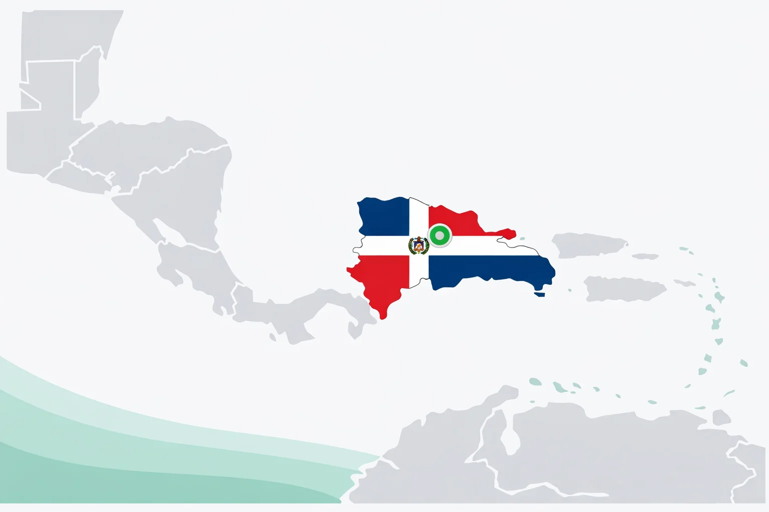
| Dominica ↔ Dominican Republic | Completely different places. Dominica is a tiny Lesser Antilles island. DR is half of Hispaniola. |
| Guatemala ↔ Honduras | Guatemala is in the northwest corner, touching Mexico. Honduras is to the east and south of Guatemala. |
| Saint Lucia ↔ Saint Vincent | Saint Lucia is above Saint Vincent in the chain. "L before V" alphabetically = north before south. |
| Costa Rica ↔ Panama | Costa Rica is above Panama. Panama curves eastward and connects to South America. |
All 6 Score Tiers Explained
Your quiz result places you in one of six tiers based on how many of the 20 countries you click correctly:
🏆 Perfect Score (20/20): Every country clicked correctly — mainland nations, Greater Antilles, and the entire Lesser Antilles chain without a single miss. Only about 5% of first-time players pull this off. Your mental map of the region is razor-sharp.
🌟 Caribbean Expert (17-19): Near-perfect. Your 1-3 misses are almost always in the Lesser Antilles chain where tiny islands stack close together. You know the region well — one focused review of the island arc should push you to a clean 20. Top 12%.
🎯 Regional Navigator (13-16): The mainland and bigger islands are solid. The small Caribbean nations and maybe one Honduras-Nicaragua swap are holding you back. Better than 60% of players — a few targeted retakes will have you in the expert range.
🧭 Getting There (8-12): Cuba, Jamaica, Guatemala, and Panama are clicking into place. The middle of the isthmus and the island chain need more practice. This is the average first-attempt score for this quiz.
🗺️ Island Explorer (4-7): You know the big landmarks. Twenty countries is a lot for one region — but the quiz teaches you every time you miss, so two more rounds will dramatically improve your score.
🌴 Fresh Start (0-3): No shame in starting here. This region packs 20 countries into an area with tiny islands that most people never study in school. The feedback loop means every retake makes you better. Start by learning the 7 mainland countries, then tackle the islands.
8 Surprising Facts About Central America
Connecting facts to countries creates memory hooks that pure map study doesn't provide. Here are eight that tend to stick:
- The Panama Canaldoesn't run east-west. It runs roughly northwest to southeast. The Pacific end of the canal is actually eastof the Atlantic end — a fact that breaks most people's mental model.
- Belize is the only English-speaking country in Central America. It was a British colony (British Honduras) until 1981. Guatemala still claims parts of its territory.
- El Salvador is the only Central American country with no Caribbean coast. Every other mainland nation touches both the Pacific and Caribbean/Atlantic.
- Cuba is larger than all other Caribbean islands combined. At 109,884 km², it's bigger than Iceland and about the size of Bulgaria.
- Trinidad and Tobago sits just 11 km from Venezuela. Geologically, it was part of the South American mainland until about 10,000 years ago.
- Costa Rica has no army. It abolished its military in 1948 after a civil war. The money goes to education and healthcare instead — it consistently ranks among the happiest countries in the world.
- Haiti was the first Caribbean nation to gain independence (1804) and only the second country in the Americas after the United States. It was also the first country founded by formerly enslaved people.
- Saint Kitts and Nevis is the smallest sovereign state in the Americas by both area (261 km²) and population (~47,000). You could walk across the main island in about 3 hours.
How to Lock This Map Into Your Memory
Spatial learning requires spatial practice. Reading a list of country names doesn't build the same neural connections as clicking them on a map. The hippocampus, which handles spatial navigation in your brain, activates strongly during map-based tasks. That's why map quizzes feel different from flashcards — you're building a mental model of where things are relative to each other, not just whatthey're called.
Anchor, then fill. Start with the countries you already know — Cuba, Jamaica, Panama. Those become your fixed points. Everything else gets placed relative to them. Guatemala is where Central America starts in the northwest. Trinidad and Tobago is where the Caribbean ends in the south. The Lesser Antilles arc connects them on the eastern edge.
Use the miss list.After each round, the quiz shows which countries you got wrong. Don't just retry blindly — look at those specific countries, note which region they're in, and focus your next attempt on that cluster. Targeted retrieval practice outperforms broad review according to decades of cognitive research (Roediger & Butler, Trends in Cognitive Sciences, 2011).
Ready to expand your map knowledge? Head south with our South America map quiz (12 countries), or jump across the Atlantic to the Europe map quiz where 44 countries pack into a smaller space. Each quiz builds on the spatial memory skills you're developing here.